Tuesday, September 6, 2016

Zion National Park (Southern Utah)

Over 30 years ago I had the pleasure of visiting Zion National park. If I remember correctly I was with my younger brother Joe and his wife Karen and their youngest daughter Ashlee. For Sharon our visit this time was her first. As she has with all our visits to National Parks and National Monuments on our Rambling Journey she had gathered information so we could take advantage of the best of all the parks.

We both were so excited we could not sleep the night before we were to go to Zion. So we got up early and headed out to ZION NATIONAL PARK. We had made St George Utah our home base for our visit to some of the parks while here in Southern Utah. So we had to drive several miles to get to our Zion destination. If you are not aware during the busy time of the season (May through October) when you visit Zion you have to park your car at the entrance and shuttles run every 15 minutes and drop or pick you up at several difference spots thorough out the park. If you want a parking spot from May through mid September you will need to arrive between 9:00 AM or after 3:00 PM. By limiting parking they are able to limit the number of guess in the parks at one time. Works better for better enjoyment of all while in the parks. 

In Zion as with several of the  parks we have been in, Rangers warn you constantly to be aware at all times for wild animals as well as bad weather. In Zion they told us specifically do not enter a narrow canyon during bad weather.  It is possible for a storm to be several miles away and still have a sudden rush of water come through a small canyon. Whether hiking the many trails, climbing, or canyoneering ones safety depends on your own good judgement, adequate preparation, and instant attention to your surrounding. I mention this because it is unbelievable how people violate these 2 principles. Rangers tell us that since social media has become so popular destruction in parks have decreased.

This year is the celebration of 100 years of the National Parks system.  We have found all the National parks we have visited to be in very good shape and appear to be well managed. In the more popular parks we have been in we have found that they are very organized and well prepared to accommodate the large number of visitors. We have found that not to be so in some of the state parks however.

On the east entrance of Zion canyon you have to go through a mile long tunnel which was built back in the early 19 hundreds. It is well supported and well taken care of but with the big rigs of today one has to drive in the middle of the tunnel so not to scrape on the edge. That means to go through the tunnel one has to schedule a time to go through. Of course the tunnel has to be closed down for a few minutes as the big rig passes through. Just be aware if you plan on going through the east entrance.  

So much for my rambling lets look at a few of the amazing picture we collected during our visit.
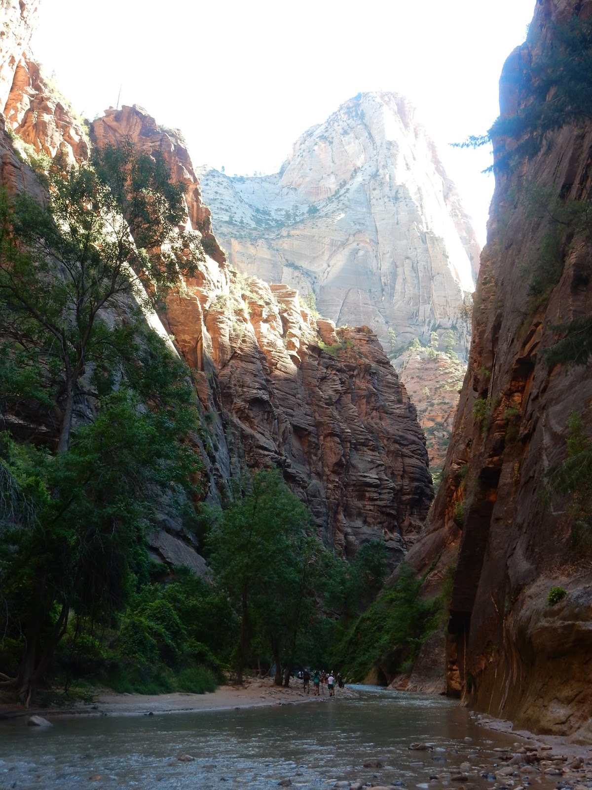
Next picture below is this canyon

Temple of Sinawava


Checkerboard Mountain
Close up of checkerboard formation on Mt. side
  
Explaining the next picture below


Tuesday, August 23, 2016

Monument Valley (for all you movie fans, especially western fans)

Located in the heart of Navajo Nation in Southeastern Utah  near the Arizona border is the Monument Valley. Our interest for going here was of course the great monuments that are there but also the movies that have been filmed at or near that location. I have always been a western movie fan and wanted to some day see the real thing that I often saw in the background of some of the moves I watched. Especially John Wayne movies. We have included in this blog some of the most interesting sites we observed.
Although many other movies (21+) have been filmed in Monument Valley, tourist consider Monument Valley belonging to one Hollywood actor, John Wayne. In the Moab area (southern Utah) several dozen movies have been filmed.
We took the scenic road from Moab to Monument valley. It included about 3 miles of very steep and gravel road that had a lot of switchbacks. Good thing new cars can now drive themselves. LOL!!  I enjoyed the ride as well as the view but Sharon not so much!!!! The gravel switchback is called Moki Dugway. It winds 1200 feet from top to bottom on a 3 mile gravel road at an 11% grade but actually very safe most vehicles.
What the valley looked like that where we were headed. The road you see is the road  we would be taking to get to Mexican Hat Utah and then on to Monument Valley.


The gravel switchback road we were to capture to get to the valley so we could continue to Monument Valley

More of the switchback road.
 
Offered the Duke an Ozark handshake

Hey partner call me Duke, how about a photo shot together.

Where the Duke  stayed while doing the 5 movies he did in Monument valley (Stagecoach 1939, Fort Apache 1948, Rio Grande 1950, The Searchers 1956, She wore a yellow ribbon 1959,
 
Remember the movie Forest Gump  and long run. It was filmed down this stretch of road.

Have you ever seem this background in a western or other movies.


Thursday, August 18, 2016

Canyonlands: Just a few miles from Moab National Arches Park

Canyonlands a few miles from the National Arches Park of Moab. Arches are formed mainly by wind and Canyons mainly by water. It is very interesting that these 2 parks are closely located and both are beautiful but in very different ways. Canyonland preserves are a wilderness of rocks at the Colorado plateau. It's primary architect is water and gravity. It has 2 big rivers that run through it named Colorado and Green rivers. They come together  about mid way of the Canyonlands park.

We spend the bigger part of 2 days in the park at different locations. The first day was a place called Island in the Sky. The 2nd day we spend in the southern part called Needles. Two different types of rocks and formations is very different


Note The unique formation called Old Wooden shoe

Up close view of Old Wooden shoe (rock formation)


Note white the different colors of rock. The white rock is harder than the red rock (sand rock) and does not erode as fast as the Sand Rock. Makes for some very unique formations.

Some pictographs inside the needles Park

Old Corral just inside of Needles Canyon. We crossed many open range and cattle guards while going to and in the park.s.
 
Needle looking rock formations  


Moab Utah Home of the Arches

Arches National Park was established as a monument in 1929 and gained national park status in 1971. The park preserves over 2500 natural arches of all shapes and sizes, as well as a variety of balanced rocks, fins and pinnacles. It is a 76000 acres of park that has good paved roads with many pull off and parking lots at different places. The park during the summer is very busy during the midday. The park service usually has to turn traffic away for a few hours during midday. We always went in around sun up or after 3:00 PM. Best time to catch rocks and shadows from the sun. Some amazing picture opportunities.
The following pictures will give you some idea of some of the great natural features of the park and area. We were in OWW as we drove through and hiked some of the trails.
Landscape Arche
Courthouse rock


Balance Rock
One of the most photographed arches called the "Delicate Arch".

Windows Arches

Another one of the Window Arches

As the sun bounces off of the Courthouse Rock


Tuesday, August 9, 2016

Tucumcari 1986 Class reunion (and flash back for JD)


Tucumcari Mountain the first thing you see when getting close to town from either direction on Hi 1-40
New High School (at least new in the last few years) In the same locating where I taught but newer building
On the 6th of August I had the honor to speak at the class reunion of the Tucumcari Rattlers in Tucumcari New Mexico. I was Director of Guidance and Track Coach for the 4 years these students were in High School (1982--1986). It was such an honor to be ask to come back to their 30 years reunion and give a small talk to them and to see all those in attendance.

I have included a few picture of not only the reunion but a few pictures around the town. When I lived there in Tucumcari the town had a population between 9000 and 10000. It now has had some major decline in population but still has a lot of pride as noted by the great school facilities it has. Also since the old highway 66 went through the heart of town it has some great vintage building, hotels etc. I have included some old pictures of some old great hotels as well as neon signs along Tucumcari Blvd where old Highway 66 run as well as some murals around town that tells the story of the history of the town and area.
JD while giving his presentation

JD with a couple colleagues while he was at Tucumcari 


. 
Casual view of class of 1986

Set down photo of the Rattler class of 1986
More of the New High School at Tucumcari

High School Auditorium  


First Baptist Church where I was Baptized
Where I lived when I was in Tucumcari on 2nd street across from Library

A great vintage hotel on the Tucumcari Blvd ( a great place to stay)

One of many Murals in and around the town depicting the historical events 


When I lived in Tucumcari I would go out of town to this certain spot and every time see Antelope. 30 years later we went out to the same area and it was still there. LOL
Another favorite spot I use to go to for a little R&R